Aggregate processing operations in Wisconsin are under strict permits, requiring all storm water to be internally drained. These measures are to ensure no fine sediment-laden water enters Wisconsin's waterways from the mine sites. If the sediment were to enter streams, it would damage habitat for numerous aquatic species, as eggs and food sources would become buried. If an aggregate operation fails to meet their permit requirements, they face steep fines. This project seeks to derive accurate flow models from UAS sourced data, in order to assess the drainage paths of water from an active aggregate operation.
When modeling surface water flow with a Digital Surface Model (DSM), vegetation can spuriously alter the direction, greatly reducing the accuracy of the results. In order to increase the accuracy of the flow models, vegetation will be removed using object-based Random-Forest classification and Esri point cloud tools.
Methods:
The imagery was captured using the Sentek GEMS sensor on May 2nd, 2016, and was recorded as an RGB and a single-band NIR jpeg images. The images were processed in the Sentek GEMS software, and were then aligned using Esri's 'image stack' tool. Next, the stacked images were imported into Pix4D with RTK-recorded GCP points. I ran the images with the GCPs, and generated a densified point cloud, orthomosaic, and DSM.
I used Trimble eCognition to perform object based segmentation on the orthomosaic. The classified results were next brought into ArcMap, and converted to polygons. The vegetation polygons were then used to classify the point cloud using the 'Classify Las by Feature Tool'. A Digital Terrain Model (DTM) was then generated from the classified point cloud.
Next, the culvert locations were digitized and burned into the DTM, and the reservoirs were filled to their holding capacities. The flow was calculated with these simulated capacities, in order to see how the water would flow in this situation.
The flow was modeled in an iterative manner. First, the algorithm calculated the total fill amount for each sink to flow into another. Next, the average fill value was used to perform fill, flow direction, and flow accumulation tools. The flow accumulation tool was visualized using 1/4 standard deviation breaks, and the value of the smallest break was used to run the con tool - limiting the flow accumulation raster to only values greater than 350. The output of the con tool was used to create stream links and calculate stream order. The stream order was then converted into vector for display and interpretation.
Results:
The DSM generated by Pix4D was very smooth, but didn't represent the landscape realistically overall (Figure 1).
 |
| Figure 1: This is the DSM generated by Pix4d. |
 |
| Figure 2: Vegetation Classification. |
Following the classification of the point cloud, a DTM was generated, and the results were less than perfect (Figure 3). The poor results were due to the vegetation classifier's inability to accurately classify woody vegetation, leaving much of it unclassified (Figure 4).
 |
| Figure 3: This DTM was generated from the classified point cloud. |
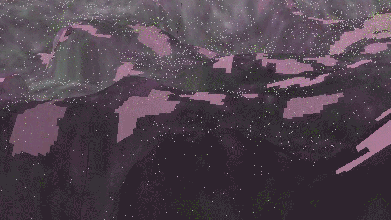 |
| Figure 4: The pink polygons are the areas classified as 'vegetation' on the orthomosaic. The polygons were used to classify points into the 'vegetation' class. Unfortunately, the vegetation identified during the classification process only partially classified the actual vegetation. |
 |
| Figure : In order to more accurately model the flow, the vegetation was completely removed, the culverts were burned into the DTM, and the reservoirs were filled to their outflow elevation. |
No comments:
Post a Comment